
Order Total (1 Item Items):
Shipping Destination:

national geographic maps evergreen (Over 1,500 results)
Skip to main search results
Product Type
- All Product Types
- Books (1,574)
- Magazines & Periodicals
- Comics
- Sheet Music
- Art, Prints & Posters
- Photographs
- Maps (3)
- Manuscripts & Paper Collectibles
Condition
Binding
- All Bindings
- Hardcover
- Softcover (47)
Collectible Attributes
- First Edition
- Signed
- Dust Jacket
- Seller-Supplied Images (442)
- Not Print on Demand (1,577)
Free Shipping
Seller Location
Seller Rating
-
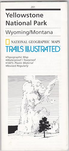
Yellowstone National Park, Wyoming/Montana (National Geographic Maps / Trails Illustrated, 201)
Published by National Geographic Maps / Trails Illustrated, Evergreen, Colorado, 1994
ISBN 10: 0925873012ISBN 13: 9780925873019
Map
Map, folding. Condition: As New. National Geographic Maps / Trails Illustrated, 1994. Map, folding. Color. Printed on both sides on waterproof/tearproof plastic. Sheet 65 x 96 cm., folded to 23 x 11 cm. Relief shown by contours and spot heights. Depths shown by contours and soundings. As New. Not from a library.
-
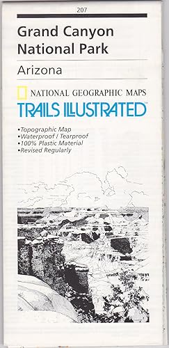
Grand Canyon National Park, Arizona (National Geographic Maps / Trails Illustrated, 207)
Published by National Geographic Maps / Trails Illustrated, Evergreen, Colorado, 1994
ISBN 10: 0925873071ISBN 13: 9780925873071
Map
Map, folding. Condition: As New. Evergreen, Colorado: National Geographic Maps / Trails Illustrated, 1994. Map, folding. Color. Printed on both sides on waterproof/tearproof plastic. Sheet 65 x 95 cm., folded to 23 x 11 cm. Relief shown by contours and spot heights. As New. Not from a library.
-
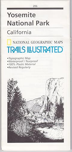
Yosemite National Park, California (National Geographic Maps / Trails Illustrated, 206)
Published by National Geographic Maps / Trails Illustrated, Evergreen, Colorado, 1996
ISBN 10: 0925873063ISBN 13: 9780925873064
Map
Map, folding. Condition: As New. Evergreen, Colorado: National Geographic Maps / Trails Illustrated, 1996. Map, folding. Color. Printed on both sides on waterproof/tearproof plastic. Sheet 65 x 94 cm., folded to 23 x 11 cm. Relief shown by contours and spot heights. As New. Not from a library.
-
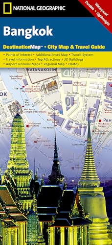
Bangkok (Folded)
Published by National Geographic Maps, Evergreen, 2012
ISBN 10: 1597754587ISBN 13: 9781597754583
Book
Folded. Condition: new. Folded. In addition to the easy-to-read map on the front, the back includes: Regional map - Airport diagram - Skytrain map - Express boat service map - Information on transportation, shopping, tipping, and more - Multi-language legend. The newly redesigned National Geographic DestinationMaps series strikes the perfect balance between map and guidebook, and they are the ideal resource for touring culturally and geographically unique areas. All maps are double-sided with beautiful photos and detailed travel information, including comprehensive road networks, local information and natural, historical and cultural places of interest. The maps are printed on durable, waterproof, tear-resistant material that is lightweight and easily folded to fit in your pocket. Scale : 1:14,300 Flat Size : 635 x 457 mm. Shipping may be from multiple locations in the US or from the UK, depending on stock availability.
More buying choices from other sellers on AbeBooks
New offers from US$ 15.17
-
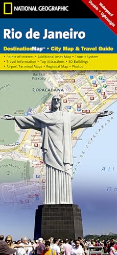
Rio De Janeiro (Folded)
Published by National Geographic Maps, Evergreen, 2012
ISBN 10: 1597752037ISBN 13: 9781597752039
Book
Folded. Condition: new. Folded. The front side features a large-scale city map, richly layered with tourist and business travel locations and information. 3-D styled drawings show famous buildings and landmarks for easy orientation. The reverse side includes regional maps, top attractions, airport diagrams, travel tips, transit maps and an extensive index to streets, cities, neighborhoods, parks, points of interest, museums, monuments, government buildings, hotels, and more. Includes a multi-language legend. Shipping may be from multiple locations in the US or from the UK, depending on stock availability.
More buying choices from other sellers on AbeBooks
New offers from US$ 15.94
-
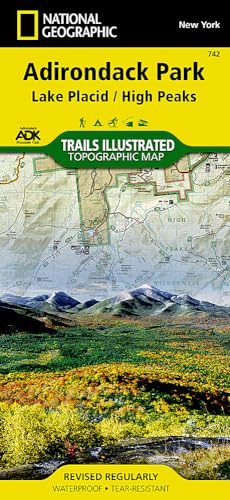
Lake Placid/high Peaks, Adirondack Park (Folded)
Published by National Geographic Maps, Evergreen, 2012
ISBN 10: 156695357XISBN 13: 9781566953573
Book
Folded. Condition: new. Folded. National Geographic's Trails Illustrated Maps are the most detailed and up-to-date topographic recreation maps available for US National Parks, National Forests and other popular outdoor recreation areas. A necessity for exploring the outdoors, each map is printed on waterproof, tear-resistant material. They also contain key safety and contact information, GPS and compass coordinates, Leave No Trace ethical guidelines and hundreds of points-of-interest, including scenic viewpoints, campgrounds, boat launches, swimming areas, marine sanctuaries and wildlife refuges. Shipping may be from multiple locations in the US or from the UK, depending on stock availability.
More buying choices from other sellers on AbeBooks
New offers from US$ 16.17
-

Pikes Peak / Canon City
Published by National Geographic Maps, Evergreen, CO, 2023
ISBN 10: 1566953987ISBN 13: 9781566953986
Book
No Binding. Condition: New. Nat Geo Map # 137. Mint condition. Extremely detailed. Waterproof.
More buying choices from other sellers on AbeBooks
New offers from US$ 12.65
-

Mount Rogers High Country (Trails Illustrated Topographic Map)
Published by National Geographic Maps, Evergreen, CO, 2019
ISBN 10: 1566956641ISBN 13: 9781566956642
Book
No Binding. Condition: New. Map of a small but popular area in far southwestern Virginia. Map is brand new.
More buying choices from other sellers on AbeBooks
New offers from US$ 12.90
-
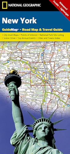
New York (Folded)
Published by National Geographic Maps, Evergreen, 2016
ISBN 10: 1597753157ISBN 13: 9781597753159
Book
Folded. Condition: new. Folded. While GPS is handy for navigating unfamiliar cities, there is nothing better than a printed map for simplicity, perspective and fun on road trips. National Geographic's State Guide Maps are the perfect combination of detailed map and travel guide. Each map contains scenic drives, parks and recreation maps, as well as insets of cities and useful information on local attractions and events. The maps are printed on durable, waterproof, tear-resistant material that is lightweight and easily folded to fit in your pocket. Shipping may be from multiple locations in the US or from the UK, depending on stock availability.
More buying choices from other sellers on AbeBooks
New offers from US$ 16.95
-
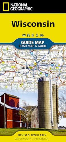
Wisconsin (Folded)
Published by National Geographic Maps, Evergreen, 2017
ISBN 10: 156695732XISBN 13: 9781566957328
Book
Folded. Condition: new. Folded. National Geographic's Wisconsin Guide Map provides travelers with the perfect combination of detail and perspective in a highly functional travel tool. Cities and towns are clearly indicated and easy to find in the user-friendly index. A complete road network of highways, tollways, and other roads, along with distances noted in miles for major highways, will help you find the route that's right for you. National and state parks, public campsites, visitor information centers, airports, ski areas, hospitals, and more are noted as well. Shipping may be from multiple locations in the US or from the UK, depending on stock availability.
More buying choices from other sellers on AbeBooks
New offers from US$ 17.18
-
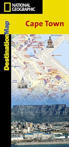
Cape Town Destination City Maps (National Geographic Destination City Map)
Published by National Geographic Maps, United States, Evergreen, 2013
ISBN 10: 1566951682ISBN 13: 9781566951685
Book
Paperback. Condition: Very Good. The newly redesigned National Geographic DestinationMaps series strikes the perfect balance between map and guidebook, and they are the ideal resource for touring culturally and geographically unique areas. All maps are double-sided with beautiful photos and detailed travel information, including comprehensive road networks, local information and natural, historical and cultural places of interest. The maps are printed on durable, waterproof, tear-resistant material that is lightweight and easily folded to fit in your pocket. The book has been read, but is in excellent condition. Pages are intact and not marred by notes or highlighting. The spine remains undamaged.
-
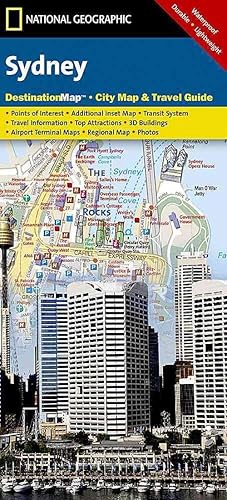
Sydney (Folded)
Published by National Geographic Maps, Evergreen, 2012
ISBN 10: 1597754021ISBN 13: 9781597754026
Book
Folded. Condition: new. Folded. In addition to the easy-to-read map on the front, the back includes: Regional map - Points of interest - Airport diagram - City Rail map - Information on transportation, tourist offices, museums, and more - Inset map of Homebush Bay Olympic Park - Multi-language legend In addition to the easy-to-read map on the front, the back includes: - Regional map - Points of interest - Airport diagram - City Rail map - Information on transportation, tourist offices, museums, and more - Inset map of Homebush Bay Olympic Park - Multi-language legend Shipping may be from multiple locations in the US or from the UK, depending on stock availability.
More buying choices from other sellers on AbeBooks
New offers from US$ 17.22
-
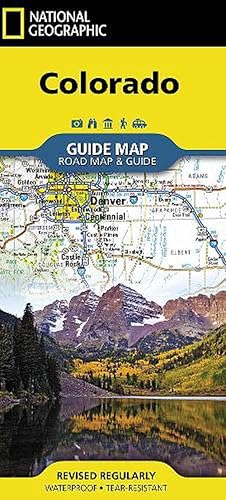
Colorado (Folded)
Published by National Geographic Maps, Evergreen, 2018
ISBN 10: 156695777XISBN 13: 9781566957779
Book
Folded. Condition: new. Folded. While GPS is handy for navigating unfamiliar cities, there is nothing better than a printed map for simplicity, perspective and fun on road trips. National Geographic's State Guide Maps are the perfect combination of detailed map and travel guide. Each map contains scenic drives, parks and recreation maps, as well as insets of cities and useful information on local attractions and events. The maps are printed on durable, waterproof, tear-resistant material that is lightweight and easily folded to fit in your pocket. Shipping may be from multiple locations in the US or from the UK, depending on stock availability.
More buying choices from other sellers on AbeBooks
New offers from US$ 17.31
-
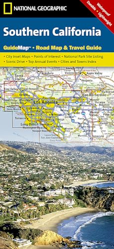
Southern California (Folded)
Published by National Geographic Maps, Evergreen, 2006
ISBN 10: 1597750158ISBN 13: 9781597750158
Book
Folded. Condition: new. Folded. Scale = 1/2,074M edition = 2007. While GPS is handy for navigating unfamiliar cities, there is nothing better than a printed map for simplicity, perspective and fun on road trips. National Geographic's State Guide Maps are the perfect combination of detailed map and travel guide. Each map contains scenic drives, parks and recreation maps, as well as insets of cities and useful information on local attractions and events. The maps are printed on durable, waterproof, tear-resistant material that is lightweight and easily folded to fit in your pocket. Shipping may be from multiple locations in the US or from the UK, depending on stock availability.
More buying choices from other sellers on AbeBooks
New offers from US$ 17.34
-
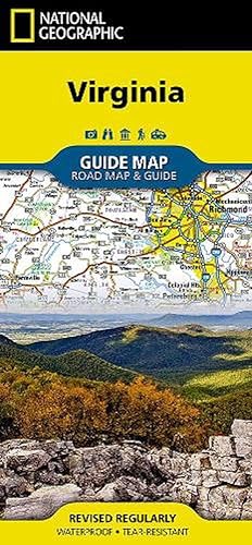
Virginia (Folded)
Published by National Geographic Maps, Evergreen, 2012
ISBN 10: 1597750603ISBN 13: 9781597750608
Book
Folded. Condition: new. Folded. While GPS is handy for navigating unfamiliar cities, there is nothing better than a printed map for simplicity, perspective and fun on road trips. National Geographic's State Guide Maps are the perfect combination of detailed map and travel guide. Each map contains scenic drives, parks and recreation maps, as well as insets of cities and useful information on local attractions and events. The maps are printed on durable, waterproof, tear-resistant material that is lightweight and easily folded to fit in your pocket. The front side is an easy-to-read road map with insets of: - Washington DC area - Charlottesville - Lynchburg - Roanoke - Southwest Virginia - Colonial National Historical Park The back includes: - Maps and information for Richmond and Hampton Roads - Information for Shenandoah National Park - Points of interest - Scenic drive - Park Service sites in Virginia Shipping may be from multiple locations in the US or from the UK, depending on stock availability.
More buying choices from other sellers on AbeBooks
New offers from US$ 17.35
-
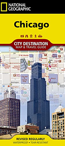
Chicago (Folded)
Published by National Geographic Maps, Evergreen, 2018
ISBN 10: 1566957818ISBN 13: 9781566957816
Book
Folded. Condition: new. Folded. The newly redesigned National Geographic DestinationMaps series strikes the perfect balance between map and guidebook, and they are the ideal resource for touring culturally and geographically unique areas. All maps are double-sided with beautiful photos and detailed travel information, including comprehensive road networks, local information and natural, historical and cultural places of interest. The maps are printed on durable, waterproof, tear-resistant material that is lightweight and easily folded to fit in your pocket. Shipping may be from multiple locations in the US or from the UK, depending on stock availability.
More buying choices from other sellers on AbeBooks
New offers from US$ 17.35
-
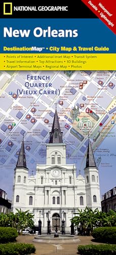
New Orleans (Folded)
Published by National Geographic Maps, Evergreen, 2010
ISBN 10: 1597754145ISBN 13: 9781597754149
Book
Folded. Condition: new. Folded. In addition to the easy-to-read map on the front, the back includes: Regional map - Points of interest - Airport diagram - Information on transportation, tipping, climate, and more - Map and information about the Louisiana Plantations - Multi-language legend Shipping may be from multiple locations in the US or from the UK, depending on stock availability.
More buying choices from other sellers on AbeBooks
New offers from US$ 17.35
-
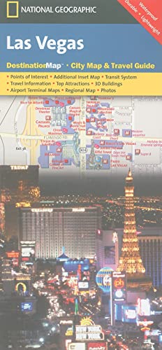
Las Vegas (Folded)
Published by National Geographic Maps, Evergreen, 2012
ISBN 10: 1597751928ISBN 13: 9781597751926
Book
Folded. Condition: new. Folded. In addition to the easy-to-read map on the front, the back includes: Regional map - Points of interest - Inset map of Downtown Las Vegas - Airport diagram - Information for Grand Canyon and Bryce Canyon National Parks - Multi-language legend. In addition to the easy-to-read map on the front, the back includes: - Regional map - Points of interest - Inset map of Downtown Las Vegas - Airport diagram - Information for Grand Canyon and Bryce Canyon National Parks - Multi-language legend. Shipping may be from multiple locations in the US or from the UK, depending on stock availability.
More buying choices from other sellers on AbeBooks
New offers from US$ 17.35
-
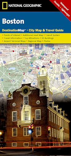
Boston (Folded)
Published by National Geographic Maps, Evergreen, 2012
ISBN 10: 1597750573ISBN 13: 9781597750578
Book
Folded. Condition: new. Folded. In addition to the easy-to-read map on the front, the back includes: Regional map - Subway map (The "T") - Airport diagram - Points of interest - Information on transportation, museums, guided tours, and more - Multi-language legend In addition to the easy-to-read map on the front, the back includes: - Regional map - Subway map (The "T") - Airport diagram - Points of interest - Information on transportation, museums, guided tours, and more - Multi-language legend Shipping may be from multiple locations in the US or from the UK, depending on stock availability.
More buying choices from other sellers on AbeBooks
New offers from US$ 17.35
-
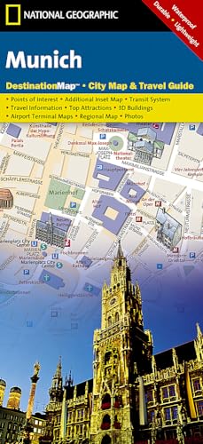
Munich (Folded)
Published by National Geographic Maps, Evergreen, 2012
ISBN 10: 1597753114ISBN 13: 9781597753111
Book
Folded. Condition: new. Folded. In addition to the easy-to-read map on the front, the back includes: Regional map - Points of interest - U-Bahn (subway) map - Airport diagram - Inset map of Schloss Nymphenburg - Map and informatioin about the Romantic Road and Bavarian Alps - Multi-language legend Shipping may be from multiple locations in the US or from the UK, depending on stock availability.
More buying choices from other sellers on AbeBooks
New offers from US$ 17.36
-

Maine (Folded)
Published by National Geographic Maps, Evergreen, 2012
ISBN 10: 1597753149ISBN 13: 9781597753142
Book
Folded. Condition: new. Folded. While GPS is handy for navigating unfamiliar cities, there is nothing better than a printed map for simplicity, perspective and fun on road trips. National Geographic's State Guide Maps are the perfect combination of detailed map and travel guide. Each map contains scenic drives, parks and recreation maps, as well as insets of cities and useful information on local attractions and events. The maps are printed on durable, waterproof, tear-resistant material that is lightweight and easily folded to fit in your pocket. Shipping may be from multiple locations in the US or from the UK, depending on stock availability.
More buying choices from other sellers on AbeBooks
New offers from US$ 17.36
-
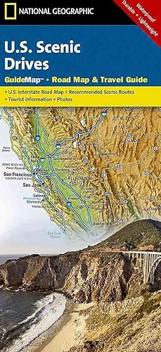
Scenic Drives USA (Folded)
Published by National Geographic Maps, Evergreen, 2012
ISBN 10: 1597750263ISBN 13: 9781597750264
Book
Folded. Condition: new. Folded. While GPS is handy for navigating unfamiliar cities, there is nothing better than a printed map for simplicity, perspective and fun on road trips. National Geographic's State Guide Maps are the perfect combination of detailed map and travel guide. Each map contains scenic drives, parks and recreation maps, as well as insets of cities and useful information on local attractions and events. The maps are printed on durable, waterproof, tear-resistant material that is lightweight and easily folded to fit in your pocket. While GPS is handy for navigating unfamiliar cities, there is nothing better than a printed map for simplicity, perspective and fun on road trips. National Geographic's State Guide Maps are the perfect combination of detailed map and travel guide. Each map contains scenic drives, parks and recreation maps, as well as insets of cities and useful information on local attractions and events. The maps are printed on durable, waterproof, tear-resistant material that is lightweight and easily folded to fit in your pocket. Shipping may be from multiple locations in the US or from the UK, depending on stock availability.
More buying choices from other sellers on AbeBooks
New offers from US$ 17.37
-
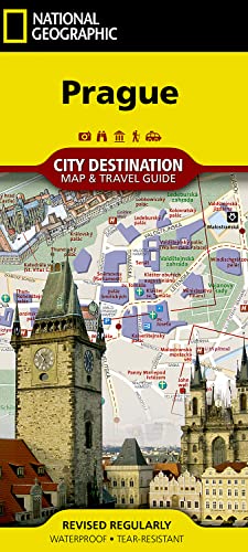
Prague (Folded)
Published by National Geographic Maps, Evergreen, 2018
ISBN 10: 1566957842ISBN 13: 9781566957847
Book
Folded. Condition: new. Folded. CityDestinationMaps blend urban guidebook information with easy to read street maps, complete with 3D buildings. The maps are printed on waterproof, tear-resistant material that's lightweight yet very durable - idea for travel. Double-sided with beautiful photos and detailed travel information, this Prague map includes an inset map of the castle district, Charles bridge, Prague region and metro lines. An extensive index and information about points of interest in Prague is also featured. Shipping may be from multiple locations in the US or from the UK, depending on stock availability.
More buying choices from other sellers on AbeBooks
New offers from US$ 17.37
-

Washington D.c. (Folded)
Published by National Geographic Maps, Evergreen, 2018
ISBN 10: 1566957303ISBN 13: 9781566957304
Book
Folded. Condition: new. Folded. The newly redesigned National Geographic Destination Maps series strikes the perfect balance between map and guidebook, and they are the ideal resource for touring culturally and geographically unique areas. All maps are double-sided with beautiful photos and detailed travel information, including comprehensive road networks, local information and natural, historical and cultural places of interest. The maps are printed on durable, waterproof, tear-resistant material that is lightweight and easily folded to fit in your pocket. Shipping may be from multiple locations in the US or from the UK, depending on stock availability.
More buying choices from other sellers on AbeBooks
New offers from US$ 17.54
-

Road Atlas: Scenic Drives Edition (united States, Canada, Mexico) (Folded)
Published by National Geographic Maps, Evergreen, 2016
ISBN 10: 1566957060ISBN 13: 9781566957069
Book
Folded. Condition: new. Folded. National Geographic's Road Atlas: Scenic Drives Edition , is the ideal companion for the next time you hit the road for an unforgettable road trip. Includes up-to-date road maps for all 50 U.S. States, plus Canada, Mexico, and Puerto Rico. Major cities and metropolitan areas are shown in detail with inset maps that include popular attractions, infrastructure and points-of-interest. Setting this atlas apart from all others is the inclusion of selection of 20 carefully researched scenic drives to help you plan the road trip of a lifetime. A map and guide section is also included for the 20 most popular National Parks. Take the guesswork out of traveling and trip planning with a comprehensive index, mileage charts, and cross-referenced pages. The Road Atlas: Adventure Edition is printed in North America and it is a convenient letter-size format that fits comfortably into glove compartments or car side door pockets. Folded Size = 8" x 11" ISBN appears to be reused with successive editions. Shipping may be from multiple locations in the US or from the UK, depending on stock availability.
-
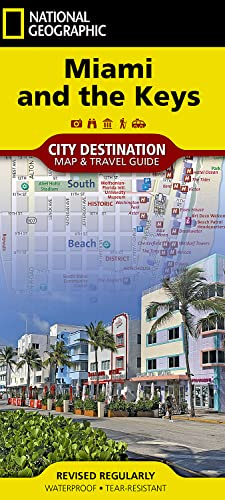
Destination Map: Miami And The Keys (Folded)
Published by National Geographic Maps, Evergreen, 2019
ISBN 10: 1566957834ISBN 13: 9781566957830
Book
Folded. Condition: new. Folded. Waterproof, Tear-Resistant Travel Map. Visitors to southern Florida will marvel at National Geographic's City Destination map of Miami and the Keys. An easy-to-read regional map and map of the Miami area are complemented by detailed maps of Downtown Miami, Miami Beach, Coconut Groves, The Everglades, Key West and the entire Florida Keys area. The maps show clearly marked road networks, that are complete with designations for through routes, main roads, one way streets and pedestrian areas. The maps pinpoint hundreds of various public transit stations, hotels, campgrounds, theaters, places of worship, beaches, parks, notable buildings and other points of interest. A user-friendly index of streets, parks, public buildings, hotels, Metrorail and Metromover stations, and other points of interest will help you find your destination and plan your route. Comprehensive maps of the Metrorail and Metromover systems along with diagrams of Miami and Ft. Lauderdale Airports and an overview of the Shipping may be from multiple locations in the US or from the UK, depending on stock availability.
More buying choices from other sellers on AbeBooks
New offers from US$ 17.71
-
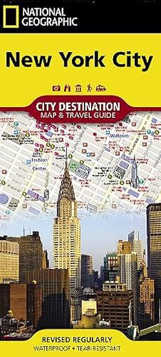
New York City (Folded)
Published by National Geographic Maps, Evergreen, 2012
ISBN 10: 1597750697ISBN 13: 9781597750691
Book
Folded. Condition: new. Folded. In addition to the easy-to-read map on the front, the back includes: Regional map - Points of interest - Inset maps of Lower Manhattan and Midtown - Subway map - Airport diagrams for LaGuardia, John F. Kennedy, and Neward Liberty airports - Multi-language legend In addition to the easy-to-read map on the front, the back includes: - Regional map - Points of interest - Inset maps of Lower Manhattan and Midtown - Subway map - Airport diagrams for LaGuardia, John F. Kennedy, and Neward Liberty airports - Multi-language legend Shipping may be from multiple locations in the US or from the UK, depending on stock availability.
More buying choices from other sellers on AbeBooks
New offers from US$ 19.21
-
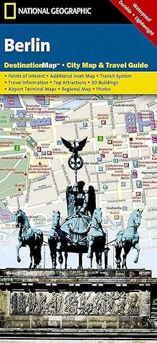
Berlin (Folded)
Published by National Geographic Maps, Evergreen, 2012
ISBN 10: 1597753106ISBN 13: 9781597753104
Book
Folded. Condition: new. Folded. In addition to the easy-to-read map on the front, the back includes: Regional map - Points of interest - Inset map of Mitte - U-Bahn and S-Bahn public transport map - Inset map of Potsdam - Airport diagram - Multi-language legend. - Waterproof - Tear-Resistant - Travel MapIn addition to the easy-to-read map on the front, the back includes: - Regional map - Points of interest - Inset map of Mitte - U-Bahn and S-Bahn public transport map - Inset map of Potsdam - Airport diagram - Multi-language legend.Map Scale = 1:15,300Sheet Size = 24.75" x 17.75"Folded Size = 4" x 8.75" Shipping may be from multiple locations in the US or from the UK, depending on stock availability.
More buying choices from other sellers on AbeBooks
New offers from US$ 19.21
-
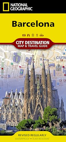
Barcelona (Folded)
Published by National Geographic Maps, Evergreen, 2012
ISBN 10: 1597754579ISBN 13: 9781597754576
Book
Folded. Condition: new. Folded. In addition to the easy-to-read map on the front, the back includes: Regional map - Inset map of Ciutat Vella - Points of interest - Airport diagram - Metro map - Information on transportation, tipping, museums, and more - Multi-language legend Shipping may be from multiple locations in the US or from the UK, depending on stock availability.
More buying choices from other sellers on AbeBooks
New offers from US$ 19.21
-
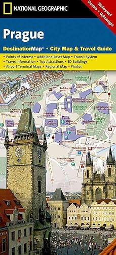
Prague (Folded)
Published by National Geographic Maps, Evergreen, 2012
ISBN 10: 159775160XISBN 13: 9781597751605
Book
Folded. Condition: new. Folded. CityDestinationMaps blend urban guidebook information with easy to read street maps, complete with 3D buildings. The maps are printed on waterproof, tear-resistant material that's lightweight yet very durable - idea for travel. Double-sided with beautiful photos and detailed travel information, this Prague map includes an inset map of the castle district, Charles bridge, Prague region and metro lines. An extensive index and information about points of interest in Prague is also featured. In addition to the easy-to-read map on the front, the back includes: - Regional map - Points of interest - Airport diagram - Metro map - Information on transportation, museums, and more - Inset map of Hradcany (Castle District) and Karluv Most (Charles Bridge) - Multi-language legend Shipping may be from multiple locations in the US or from the UK, depending on stock availability.
More buying choices from other sellers on AbeBooks
New offers from US$ 19.34